The destruction of satellite FY-1C is a catastrophic event that will mostly go unnoticed by the public. Space is increasingly becoming a matter of international interest and this self-destructive event is evidence of a growing military expansion into “the final frontier”.
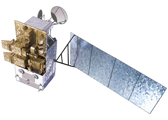
Fēngyún (FY, simplified Chinese: 风云; traditional Chinese: 風雲; lit. ‘wind cloud’) is the name of China’s meteorological satellites.
Polar-Orbiting (Odd-numbered series, e.g., FY-3): These satellites travel over the North and South Poles, crossing the equator at specific local solar times. Because the Earth spins beneath them, they travel in a Sun-synchronous orbit, allowing them to capture global weather imagery.
Geostationary (Even-numbered series, e.g., FY-2 and FY-4): These satellites travel at a much higher altitude (~35,786 km) and rotate at the exact same speed as the Earth’s rotation. This allows them to hover continuously over a fixed geographic region, providing constant, real-time tracking of weather systems, storms, and cloud formations.
Fengyun First Launched in 1988
Launched since 1988 into polar Sun-synchronous and geosynchronous orbit, each three-axis stabilized Fengyun satellite is built by the Shanghai Academy of Spaceflight Technology (SAST) and operated by the China Meteorological Administration (CMA).[1][2] To date, China has launched twenty-one Fengyun satellites in four classes (FY-1 through FY-4). Fengyun 1 and Fengyun 3 satellites are in polar, Sun-synchronous orbit and Low Earth orbit while Fengyun 2 and 4 are geosynchronous orbit.[2] (wikipedia – Fengyun)
The January 11th FengYun Event
On 11 January 2007, China destroyed one of these satellites (FY-1C, COSPAR 1999-025A) in a test of an anti-satellite missile.[3][4] According to NASA, the intentional destruction of FY-1C created more than 3,000 high-velocity debris items, a larger amount of dangerous space debris than any other space mission in history.[5]
Destruction of FY-1C
Main article: 2007 Chinese anti-satellite missile test
On 11 January 2007, China conducted its first anti-satellite (ASAT) missile test, destroying FY-1C with a kinetic kill vehicle, identified by the United States Defense Intelligence Agency (DIA) as the SC-19,[13] a modified DF-21 ballistic missile with mounted kill vehicle.[14] The shootdown, and the subsequent creation of a record-setting amount of in-orbit debris, drew serious international criticism.[15][16][17][18][19]
Results of the FY – 1C Destruction
As of early 2026, over 2,600 pieces of trackable debris from the 2007 destruction of the FY-1C satellite remain in orbit.
Trackable Objects: Around 2,679 fragments are still actively tracked by the U.S. Space Surveillance Network as of April 2026.
Smaller Particles: While the initial explosion created an estimated 150,000 to 35,000+ smaller pieces, the number of these still in orbit is lower due to atmospheric drag, though many remain dangerous, small-sized debris.
Long-term Threat: Experts from Aerospace Corp suggest that because the explosion occurred at a high altitude, much of this debris will likely remain in orbit for decades or even centuries, posing a continuous threat to satellites in low-Earth orbit (LEO).
A Catastrophic Event for Lower Earth Orbit.
Obviously this is a giant accident that the space weather community now faces the consequences of and is largely undisclosed in media. Pretty weird.. Launch a satellite and then blowing it out of the sky using a ballistic eight years later is irresponsible, at best.
These several thousand objects that will need to be avoided and cleaned out over the next century, it is quite an expensive experiment that China ran to destroy their own satellite, but it does demonstrate a bit of offensive capability.
Tracking the FY Satellites
It is important that we don’t hold grudges or seek revenge as we venture out into space. It has no place there. So whats more important is dealing with the reality of the situation that we are in now, that there are thousand of pieces of deadly satellites debris in orbit that should be removed. Hence my new project, the Upper Atmosphere Simulation in Parker’s Physics.
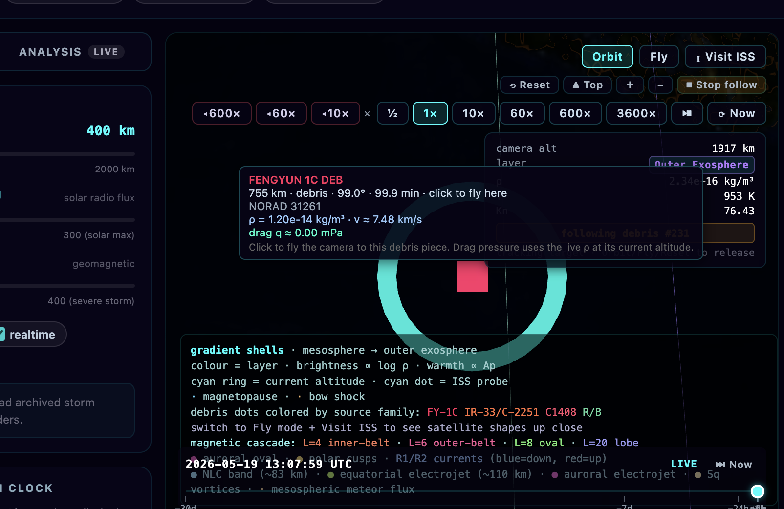
Parker’s Physics Upper Atmosphere Simulator
With the App, you can view the satellite debris orbit in real time. This is a powerful tool for predicting trajectories, and also viewing the real time locations of satellites and their trajectories against the debris. There is a lot of functionality still in the works, but the selection and time control are working well.
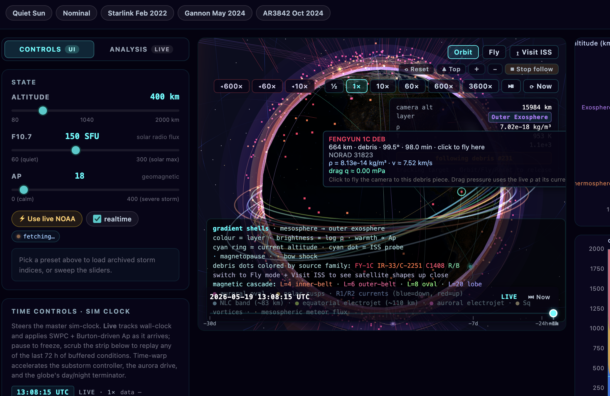
The caerma is full functional, and the zoom control and reset controls are in the upper right of the canvas. I am working on an LOD system where you can zoom in and see the individual pieces of satellite debris in real-time as well.